- Research project
- – Western Pacific
The first cohort of Master of Catchment Science (MCS) graduates are set to turn the tide on degrading water catchments, and graduate Isabelle Flook says she is now feeling well equipped to communicate with professionals from broad-ranging disciplines, thus enabling invaluable cross-disciplinary collaboration.
“I valued the breadth of subjects on offer throughout the course, with both a quantitative and qualitative program that blends natural sciences with data sciences and engineering, as well as water policy and economics, all within the overarching catchment processes framework. It is through bringing together different perspectives and knowledge bases that we can maximise our creative and problem-solving potential,” Isabelle believes.
Isabelle’s final project explored the feasibility of using remote sensing to accurately map the vine weeds, cat’s claw and rubber vine, on a catchment-wide scale.
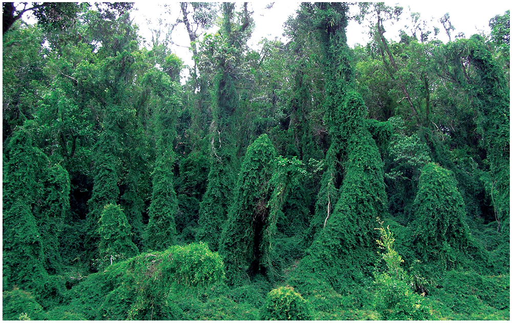
“Cat’s claw and rubber vine have aggressively invaded riparian ecosystems across eastern Australia, yet their distributions have, to date, only been identified through laborious ground observations on a very local scale,” Isabelle explains.
“These two weeds tend to smother and kill native riparian vegetation, thus stopping the riparian vegetation from performing its vital role of stabilising streambanks and reducing erosion, as well as filtering sediment and nutrients from overland flow.”
“Accurate mapping of cat’s claw and rubber vine’s distribution is a vital starting point for controlling infestations because it can both provide information about patterns of spread and assist natural resource management groups with identifying priority management areas.”
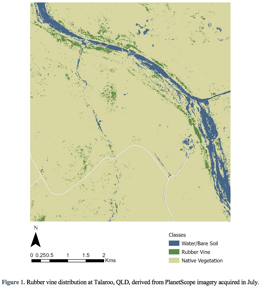
Isabelle’s study investigated the use of freely available multispectral Sentinel-2 and PlanetScope imagery for accurately mapping the weeds in two case study areas – Saplings Pocket Reserve in South East Queensland for cat’s claw and Talaroo Station in Gulf Country for rubber vine. The study explored the optimal time of year for image capture and compared the relative performance of Sentinel-2 and PlanetScope imagery, which have differing spatial and spectral resolutions.
According to Isabelle, the results were promising, particularly for rubber vine, with the ground-truthing surveys showing the model-predicted locations of rubber vine to be 80% accurate.
“Such results are encouraging and indicate further research should be conducted to enable freely available remotely sensed imagery to become a reliable tool to assist natural resource managers with allocating their resources effectively,” Isabelle said.
“I strongly valued the practical experience of conducting research and the opportunity it presented to both pursue an area of interest and to gain experience in collaborating with NRM groups.”
The MSC is hosted by the International WaterCentre and developed and delivered through collaboration with staff drawn from the Australian Rivers Institute, the School of Environment and Science, and the School of Engineering and Built Environment. It is the only catchment science dedicated postgraduate degree in the world.